

17 of the best walks in Sydney
Coastal views from Tamarama to Coogee


Step right up for hikes featuring local history, Aboriginal culture, incredible photo opportunities, unique wildlife and scenic ways to get fit – from a trail featuring 47 beaches to kid-friendly treks.
A quintessential Sydney experience – no list of the city’s best walks is complete without this coastal trail. Here, you’ll see Sydney’s most iconic attractions starting at the world-famous Bondi Beach in the Eastern Suburbs before passing through a spectacular number of sandy stretches – 47 beaches in total. Take in the city’s unmissable postcard-worthy landmarks, such as the Sydney Harbour Bridge and Sydney Opera House, and the city’s rich Aboriginal heritage, like rock engravings at Grotto Point. Need a break? Manly’s many beachside cafes, bars and restaurants are great for recharging. And if you time your visit right, you’ll witness the majestic migration of whales as they swim north off the Sydney coast.
Tip: You can approach this 80km track in various ways: an ambitious four-day coastal trek, or a slower-paced week with tourist-friendly stops at Taronga Zoo Wharf and North Head Sanctuary.
Distance: 80km one-way, between four to seven days.
Difficulty: Medium/hard – due to distance. When broken into shorter walks, it’s appropriate for most age groups and people of moderate fitness levels. There are steep sections involving stairs on occasion. This walk isn’t suited for wheelchair users or people with prams or dogs.
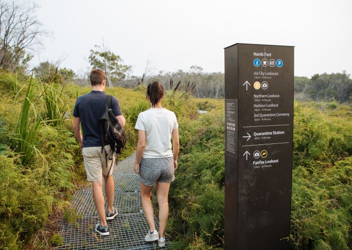
Bondi to Manly Walk, Manly
The quintessential Sydney experience, no list of the best walks in the city is complete without the Bondi to Coogee Coastal Walk. Here you’ll see Sydney’s most iconic attractions, starting at the famous Bondi Beach, passing the ever-Instagrammable Bondi Icebergs swimming club, and following the paved path that leads to the stunning Coogee Beach. You can make a full day of it by stopping at some of the many gorgeous beaches, cliff-tops, natural rock pools and cafes along the way.
Tip: Stop off at Gordon’s Bay along the way. It’s usually less crowded than the main beaches, and features an underwater nature trail that’s perfect for snorkelling.
Distance: 6km, about two to three hours.
Difficulty: Medium – mainly paved pathway with occasional steep stairs.
For an extended Northern Beaches walk with spectacular Sydney Harbour views, start here. The harbourside trail passes through Sydney Harbour National Park, subtropical bushland and stunning beaches, bays and inlets. Take in historical sites such as the Grotto Point Lighthouse and admire Aboriginal rock engravings of fish, kangaroo and boomerangs. Start at Spit Bridge and end in Manly so you can explore the suburb’s beaches, shops and restaurants for the rest of the day.
Tip: Bring a swimming costume in case you want to swim at one of the secret beaches along the way. Don’t forget to pack water, snacks, a hat and sunscreen.
Distance: 10km one way, around four hours.
Difficulty: Medium – suitable for most fitness levels, but the walk is long with steep with uneven steps along the way, so it’s not one for little kids.

Views of Sydney Harbour from Arabanoo lookout
The Glebe Foreshore Walk begins at Bicentennial Park and ends at the Sydney Fish Market, with 27 hectares of beautiful Inner West parkland and reserves to enjoy along the way. The spacious walking path runs alongside Rozelle Bay and Blackwattle Bay (making for fantastic views), and the Sydney CBD, Sydney Harbour and Anzac Bridge. It’s wheelchair accessible and a particularly great morning walk when it’s cool and Sydney’s joggers and dog walkers are out.
Tip: Post-walk, reward yourself with fresh seafood and hot chips at the Sydney Fish Market (and watch out for new restaurants by big-name chefs as the Southern Hemisphere’s largest seafood market grows even bigger).
Distance: 2.3km one way, 30 minutes to one hour.
Difficulty: Easy – a flat walk for all fitness levels.

Blackwattle Bay Park, Glebe
Barangaroo Reserve is a stunning, multi-level park in the city’s centre, with over 75,000 native plants and trees within its lush gardens. It provides views of Darling Harbour, the Sydney Harbour Bridge, Luna Park and Goat Island, as well as quiet, shady spots to sit, enjoy a picnic or hang out with a dog. The main path starts at the Hickson Road entrance, before finishing at the Towns Place roundabout, but there are several routes for wandering along the way. Take the chance to explore a modern, architecturally striking Sydney precinct with many notable restaurants and shops.
Tip: Explore the park and take in the incredible perspectives of Sydney Harbour – head up to Stargazer Lawn for a great viewpoint.
Distance: 2km one way, one to two hours depending on your route.
Difficulty: Easy – mostly flat and suitable for all fitness levels and accessibility needs.
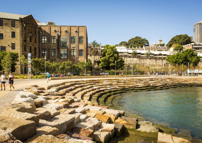
Barangaroo Reserve, Barangaroo
After a well-shaded coastal walk packed with family-friendly beaches and historical sites? On this walk you’ll start at Nielsen Park and finish up at Bayview Hill Road in Rose Bay. This trail includes five beaches where you can have a swim, picnic, take a pit stop watch the sunset, or catch views of multi-million dollar mansions, including the famous historic Strickland House, and beautiful Shark Island.
Tip: Milk Beach is our pick for the best beach for a quick stop, but try them all out and decide for yourself.
Distance: Around 1.8km one way, about 30 minutes to one hour.
Difficulty: Easy – mostly boardwalk, although there are many stairs.

Hermitage Foreshore Track section of the Sydney Harbour Bridge to South Head Walk
On this walk, expect clifftop exploration through southeast Sydney with epic rock formations and ocean views. Start at Cape Solander in the Kurnell area of Kamay Botany National Park, and enjoy spectacular views of the ocean from dramatic sandstone cliffs, before reaching Cape Baily Lighthouse. Afterwards, head to Cronulla to refuel at one of its many cafes and restaurants, or take a swim at the famous beach.
Tip: There’s no shade cover, so on hot summer days you’ll feel the full force of the sun. Bring plenty of drinking water as there is nowhere to fill up along the way.
Distance: Depending on how much time you’ve got, either do the shorter 4km one-way walk finishing at Potter Point, or the 8km return walk which takes about three hours.
Difficulty: Easy/medium – this peaceful walk is great for most visitors, especially those who love the great outdoors.
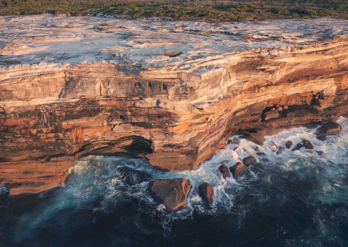
Kamay Botany Bay National Park, Kurnell
This walk is for nature lovers who want wilderness without the crowds. Start from Acron Oval in St Ives and traverse dense bushland through Garigal National Park. You’ll pass an abundance of native Australian trees and flowers en route to a beautiful set of small waterfalls and rockpools. Look out for the park’s wildlife, such as burrowing frogs, Rosenberg’s goannas and kookaburras. There are also plenty of sites with Aboriginal cave art and rock engravings to marvel at.
Tip: Bungaroo Pool used to be a public swimming hole. Few people swim there now but look out for the inscription of ‘Ladies’ in the rock: it marks the old ladies’ changing area from the early 1900s.
Distance: 3.2km return, one hour.
Difficulty: Medium – although not very long, this route can be hilly and involves bushwalking along a fire trail.
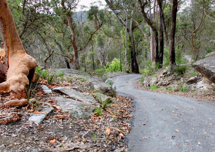
Cascades Trail, Sydney North - Credit: Shaun Sursok
Lace up your runners for a North Shore trail with a stunning view of the city and Sydney Opera House. Start at the Taronga Zoo wharf and head to Chowder Bay. You’ll walk through an old angophora forest filled with wildlife and ancient trees and then eventually get to Clifton Gardens Reserve and Chowder Bay. You’ll also encounter extraordinary views of the harbour and Sydney Opera House, as well as South Head, Rose Bay, Shark Island and Bradleys Head.
Tip: There’s not much parking at Bradleys Head, so if you’re driving then start from the Taronga Zoo end. This way, you can also stop for lunch at Ripples Chowder Bay to break up the return trip.
Distance: 4km one way, about two to three hours.
Difficulty: Easy/medium – clear pathways with many steps along the way.
Pick this Eastern Suburbs walk if you’re curious about Sydney’s rich history and also want to soak up ocean views. From Watsons Bay’s ferry terminal, you’ll follow a sidewalk along the beach until you pass through beautiful Camp Cove. From there, take the cobblestone pathways to historic Hornby Lighthouse. You’ll also stumble across a lightkeeper’s cottage, old military cannons and sandstone gun emplacements. At the lighthouse, enjoy stunning views of Sydney Harbour, Middle Head and North Head, and some whales if you’re lucky!
Tip: Linger around Watsons Bay for a while before you depart and try one of its famed restaurants – such as Doyles or Watsons Bay Boutique Hotel – or lounge around the park.
Distance: 2km, just over one hour.
Difficulty: Easy/medium – mainly paved walkway, some gentle hills and a few sections with stairs.
Get directions

Hornby Lighthouse, South Head - Credit: Kevin McGrath, DPIE
Short, relaxed and suitable for everyone, this Northern Beaches walk starts at the aptly named North Head Scenic Drive and circles the top of North Head. You’ll get stunning ocean views and a glimpse of the CBD skyline. The Yiningma and Burragula lookouts provide the kinds of views seen on Sydney postcards. This is another one for the late June-July and August-October whale watching and is great if you’re travelling with children. Just steer clear of areas closed for fire damage or geological instability.
Tip: Finished the walk but not ready to call it a day? The track connects to the Manly Scenic Walkway where you can continue walking to your heart’s content.
Distance: 1km loop, about 30 minutes to one hour.
Difficulty: Easy – paved pathway, gentle walk and wheelchair accessible.

Burragula Lookout,
Explore the Eastern Suburbs’ lush bushlands by following the Western Escarpment Track. Start at Pioneers Park in Malabar, where you’ll make your way to 360-degree views over Malabar Headland National Park, Maroubra Beach and Botany Bay. There are lookouts and seating opportunities for appreciating the views. You’ll also encounter beautiful Sydney wildlife, such as red wattlebirds, New Holland honeyeaters and blue fairy-wrens.
Tip: Look up and you might catch a glimpse of sea eagles or kestrels circling above.
Distance: 1km one way, about 20 to 30 minutes.
Difficulty: Easy/medium – short well-formed track, short steep hills and occasional steps. It’s not ideal for parents with prams or wheelchair users, since the track is a bit rough.

Malabar walking track at Malabar Headland National Park, Malabar - Credit: John Spencer/DCCEEW
The Northern Beaches views along the Barrenjoey Lighthouse Walk are epic – it’s hard to believe you’re only an hour away from Sydney’s CBD. The historic Barrenjoey Lighthouse is set 91m above sea level and takes in views of Broken Bay, Ku-ring-gai Chase National Park and the Central Coast. It’s a short but steep trek to the top but the finale is worth it. Start at the carpark on Station Beach and either ascend via Barrenjoey Lighthouse Walk or the harder Smugglers Track (or tackle one track on the way up, the other on the way down).
Tip: You’ll step through Sydney’s famous Palm Beach, where they film Home and Away.
Distance: 1km one way, about 30 minutes each direction, on the Barrenjoey Track.
Difficulty: Moderate – Barrenjoey Track is relatively easy. Smugglers Track offers a steeper and shorter trek up to the lighthouse.
Get directions

Barrenjoey Lighthouse Walk in Palm Beach, Sydney
This North Shore walk through Ku-ring-gai Chase National Park is arguably the best in Sydney for getting outdoors and learning more about the Aboriginal culture of the land’s Traditional Owners. Start from the Resolute Picnic Area at West Head Road, close to the edge of the peninsula. Follow the looping trail past the sacred Red Hands Cave to the breathtaking West Head lookout and then the secluded Resolute Beach for a uniquely Sydney walking experience. Along the way, you'll see traditional Aboriginal engravings, artworks as well as some colonial history.
Tip: Fascinated by this culturally rich route but intimidated by the harder sections? Try a shorter itinerary spanning the Resolute Picnic Area and Red Hands Cave.
Distance: 4.4km loop, three hours.
Difficulty: Moderate – this rough track features many obstacles, a steep gradient and many steps. It’s best for people with at least a moderate level of fitness or bushwalking experience. Bring sun protection, swimmers, food and plenty of water.

Resolute Beach, Ku-ring-gai Chase National Park
Despite literally bordering suburban areas of Sydney’s North Shore, Berowra Valley National Park is a vast bushland valley with more than 70km of fire trails and walking tracks. Venture from Berowra train station and its outdoor charms are soon revealed. Barnetts lookout is a serene spot with a cute creek view (kids will appreciate its small playground too) and, like Naa Badu lookout and Crosslands Reserve, it’s good for BYO picnics. The Place of Winds Interpretive Trail is a beginner-friendly walk that spans forest, mangroves and valley outlooks, while Lyrebird Gully Circuit involves more effort and care (but might bring waterfall sightings after rain – and sightings of the stunning species the track is named after). The creek is good for fishing and boating – but swimmers should watch out for council alerts and pollution levels after heavy rainfall.
Tip: The park covers a 25km stretch of the multi-day Great North walk from Sydney to Newcastle.
Distance: 9km one way, four to six hours
Difficulty: Medium/hard. This is a long walk, with steep steps, rough unformed tracks and paths can get slippery due to the many creek crossings. Some bushwalking experience is recommended. Pack sun protection, refreshments, a first-aid kit and topographic map.

Barnetts lookout, Berowra
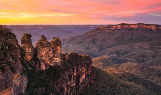
Explore the UNESCO World-Heritage-listed Blue Mountains with this one- to two-day trek. The spectacular 100m cascades from Wentworth Falls offer a sensational start. The Wentworth Falls picnic area, with its iconic, clifftop views and access to scenic tracks, is another good introduction to the area. From there, it feels like non-stop glorious lookouts. Leura is a convenient midway point for a hiking break – shop, eat and rest in this charming town before making your way to view the Three Sisters and experience a thrilling forest plunge via the planet’s steepest passenger train at Scenic World in Katoomba.
Tip: Bookend either end of your walk with miso and walnut cookies and excellent pastries from Black Cockatoo bakery, based in Katoomba and Lawson.
Distance: 19km, one to two days.
Difficulty: Easy/medium – there are steep sections, many steps and some bushwalking experience is required, but this walk can accommodate people of most fitness levels and ages.

Grand Cliff Top Walk, Wentworth Falls - Credit: Remy Brand | DCCEEW
Described as “Sydney’s biggest backyard”, Western Sydney Parklands offers more than 70km of trails tracks and other outdoor attractions. There are 11 trails to choose from, ranging from the easy Bungarribee Trail, which combines wildlife and nature (witness native wildflowers and wallabies) with family-friendly playgrounds and picnic areas, to the more physically demanding Spotted Gums trail, with its promises of more wildlife as you wind through shrubland. These walks are for everyone: there are off-leash areas for dog owners, award-winning play areas for kids, pathways bordered by towering flowers for nature lovers, walks showcasing Aboriginal art and culture, historic features and much more.
Tip: The Binyang Matta walk is named after the Dharug name for Place of Birds and is good for spotting azure kingfishers, black-shouldered kites and other feathered friends.
Distance: They range in length and time, from 25 minutes to over four hours.
Difficulty: There are beginner-friendly walks to more physically challenging and extensive hikes.
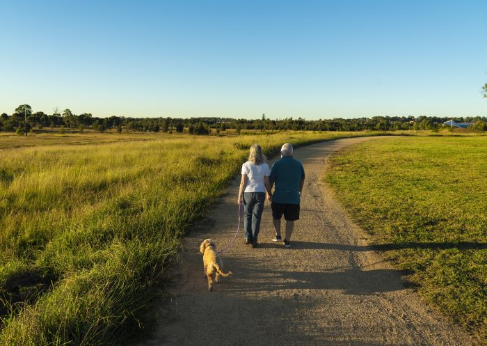
Dog walking in Western Sydney Parklands
Parks and reserves are natural environments and can be unpredictable. Plan your trip for all weather conditions, follow directions from park rangers, keep a safe distance from cliff edges and take plenty of water.
Plan ahead by checking the NPWS website for alerts and closures before visiting a park.
For more safety tips and park alerts, visit nationalparks.nsw.gov.au/safety.
Stay connected to Sydney for all the latest news, stories, upcoming events and travel inspiration.
All the insider news, tips and inspiration you need to plan your next trip, delivered straight to your inbox.
Sign UpSydney.com is the official tourism site for Destination NSW.
© Copyright 2025 Destination NSW. All rights reserved